Maps General Settings
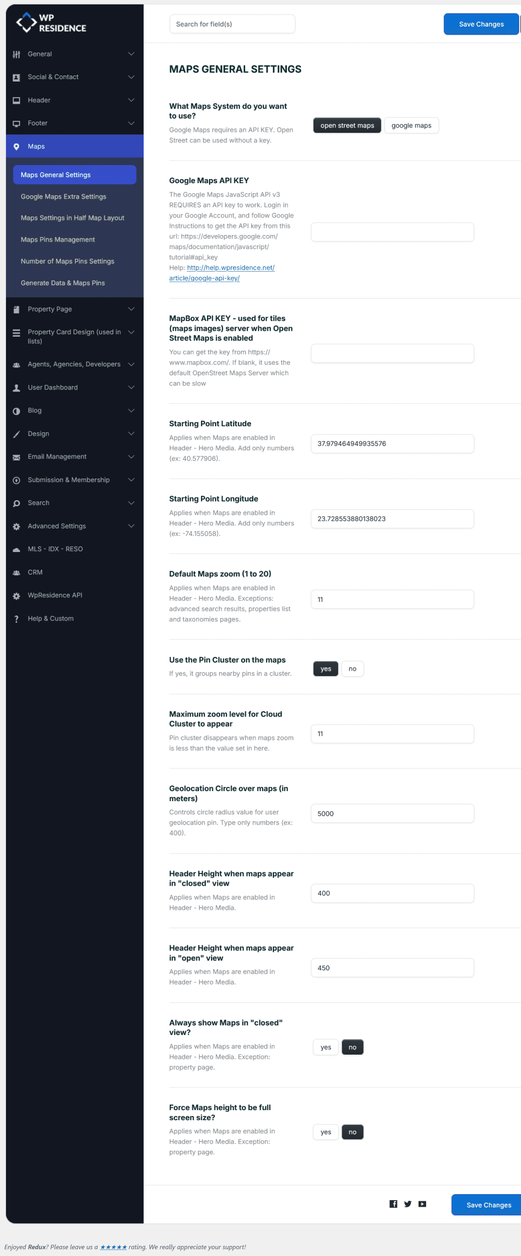
These settings allow you to configure how maps display across your site. You can choose the map provider, set API keys, and customize map behavior and appearance.
1. What Maps System do you want to use?
Choose between:
-
Google Maps – requires an API key.
-
Open Street Maps – does not require an API key.
- There are extra settings available for Google Maps. Manage them from here
2. Google Maps API KEY
The Google Maps JavaScript API v3 requires an API key to work.
-
Log in to your Google Account.
-
Follow the instructions from Google to generate an API key:
Google Documentation -
Add the key in this field.
For more details, check our help article:
How to Get Your Google API Key
3. MapBox API KEY (for Open Street Maps)
When using Open Street Maps, you can use MapBox for faster tile loading.
-
Get your free API key from: https://www.mapbox.com/
-
If left blank, the default OpenStreet Maps server is used (may load slower).
4. Starting Point Latitude / Longitude
These coordinates define the initial center of the map in the Header – Hero Media.
-
Add only numbers (examples: 40.577906, -74.155058).
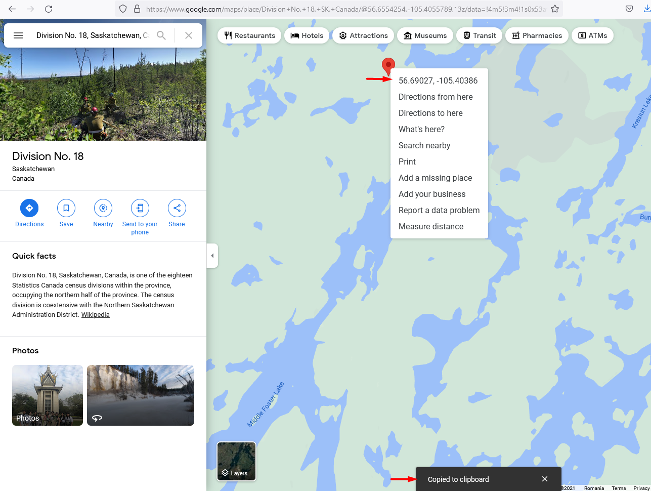
- To find out Latitude and Longitude for Google Maps, starting point go to Google Maps, find your location, click right on the location on the map and click on Coordinates. It will be automatically copied to the clipboard..
5. Default Maps Zoom (1 to 20)
Set the initial zoom level when the map is loaded in the Header – Hero Media.
-
1 = world view (zoomed out)
-
20 = street level (zoomed in)
-
Not applied to advanced search results, properties list, or taxonomy pages.
6. Use the Pin Cluster on the Maps
Enable or disable pin clustering.
-
Yes – nearby pins are grouped into clusters for easier viewing.
-
No – all pins are shown individually.
7. Maximum Zoom Level for Cloud Cluster to Appear
Set the zoom threshold at which clusters break into individual pins.
-
Example: if set to 10, clusters disappear when zoom is greater than 10.
8. Geolocation Circle over Maps (in meters)
Defines the radius (in meters) of the circle around the user’s geolocation pin.
-
Example: 400.
9. Header Height when Maps Appear in “Closed” View
Set the map container height when the map is minimized (closed view).
10. Header Height when Maps Appear in “Open” View
Set the map container height when the map is fully expanded (open view).
11. Always Show Maps in “Closed” View?
Controls whether the map in the Header – Hero Media is always loaded in closed view.
-
Yes – map always starts minimized.
-
No – map starts as configured.
-
Note: Property pages are excluded.
12. Force Maps Height to be Full Screen Size?
Makes the Header – Hero Media map always fill the screen height.
-
Yes – map covers full screen height.
-
No – uses the height defined in the settings.
-
Note: Property pages are excluded.

